
Tropical Storm Priscilla has been losing punch but could still bring flash flooding to the southwestern U.S. in coming days, forecasters say.
Priscilla went from a hurricane to a tropical storm off Mexico’s Pacific coast Wednesday, the Miami-based National Hurricane Center said, and is expected to continue to weaken and become a post-tropical cyclone by Friday.
As of early Thursday, Priscilla was some 165 miles west-southwest of the southern tip of Baja, California, with maximum sustained winds of 45 mph, the hurricane center said. It was moving northwest at 8 mph. A tropical storm has sustained winds between 39 and 73 mph.
NOAA/National Hurricane Center 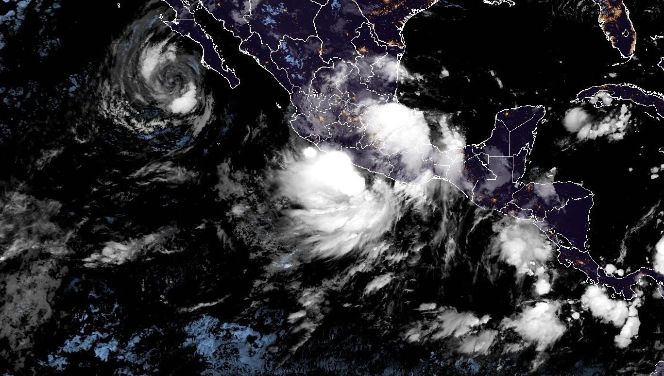
Tropical Storm Priscilla’s track and forecast
On the forecast track, Priscilla’s core “is expected to move parallel to, but offshore of, the coast of Baja California Sur through today,” the hurricane center said Thursday.
“As Priscilla moves off the west coast of Baja California, up to an inch of rain is expected across the Baja California peninsula,” it pointed out.
Nikki Nolan/CBS News 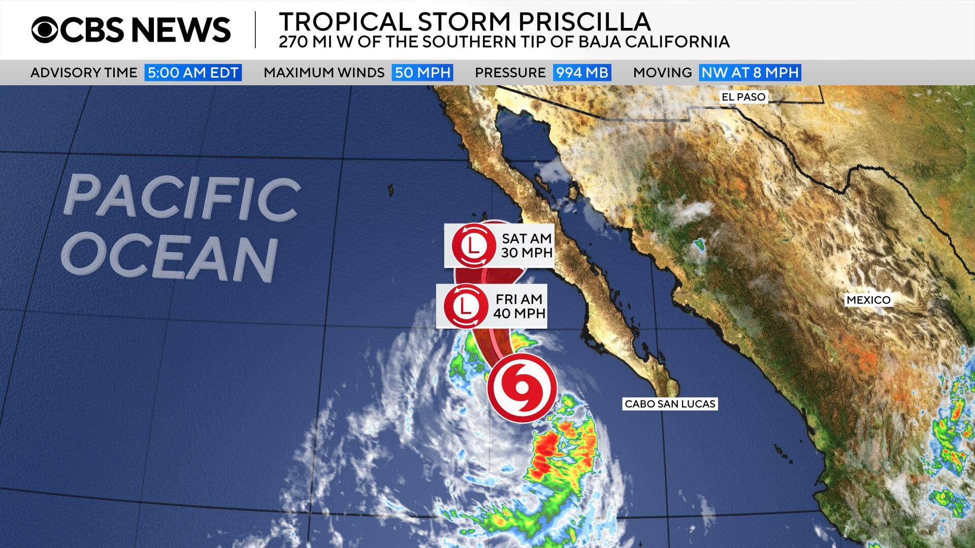
But for the southwestern U.S., two-to-four inches of rain, with as much as six inches in some places “are expected across portions of central and northern Arizona, southern Utah, and southwest Colorado through Saturday afternoon,” the center said. “Numerous occurrences of flash flooding are anticipated in central Arizona, with scattered instances of flash flooding expected across the remainder of Arizona, southern Utah, southwest Colorado, and far northwest New Mexico. “
Nikki Nolan / CBS News 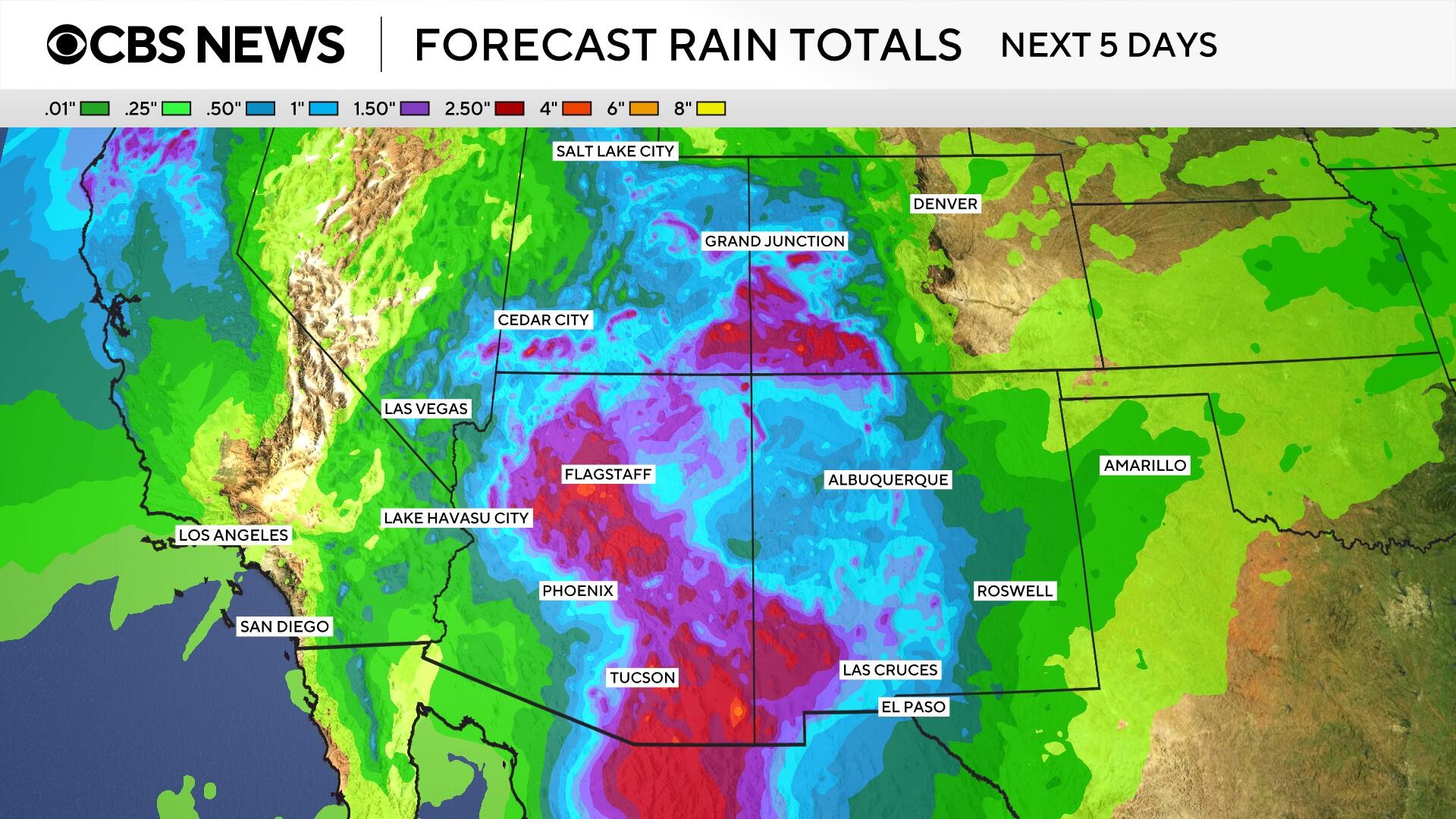
The center cautioned that “large swells generated by Priscilla are affecting the Pacific coast of Baja California Sur as well as portions of coastal southwestern and west-central Mexico. These swells are likely to cause life-threatening surf and rip current conditions, in addition to some coastal flooding.”